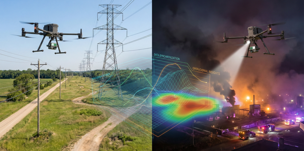
Firefighters could not safely approach the site.
Toxic gas filled the area, visibility was limited, and time mattered.
A drone went up instead.
Live aerial footage gave responders a clear view of the scene so they could adjust suppression efforts without putting crews in danger. In another response conducted at night, thermal imaging tracked movement through fire-suppressing foam and guided teams to specific valves to stop the fuel source.
This is where drone experience matters most, when access is restricted and decisions have consequences.
Broadband Is Where Drone Discipline Is Learned
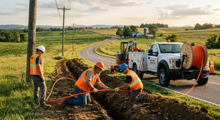
CHR Solutions has used drones for years to support broadband engineering projects. These flights are not casual surveys. They take place near live power lines, towers, and shared utility corridors, often in regulated or restricted airspace.
In broadband builds, incomplete data or missed assets can delay design, stall permitting, or force repeat site visits. There is little margin for error.
Jake Webb, Geographic Information Systems Manager at CHR Solutions, explained that effective drone use depends on understanding both airspace rules and engineering data requirements.
Knowing how to navigate Federal Aviation Administration regulations while still collecting usable data is critical.
That experience becomes a proving ground. The discipline required for broadband projects carries directly into other environments where safety, accuracy, and compliance matter.
From Broadband Corridors to Construction Sites
Construction projects benefit from the same drone-based documentation used in broadband corridors.
Flights are scheduled to capture specific stages of work, including concrete pours and utility placement. Each flight creates a time-stamped visual record of site conditions. If questions arise later about sequencing, access, or workmanship, the aerial record provides context that ground-level photos or written notes often miss.
The value is not the flight itself. It is the ability to return to a precise moment in time and see what was happening across the entire site.
Real-Time Visibility in Emergency Response
Drone experience gained from operating near live infrastructure also applies directly to emergency response situations.
Mitchell McConnell, Geographic Information Systems Supervisor at CHR Solutions, has supported drone deployments during hazardous incidents where responders could not safely approach the scene.
In one case, a drone provided live aerial visibility during a tank fire releasing toxic gases. In another, thermal imaging was used at night to track movement in low-visibility conditions and guide responders to critical control points.
When direct observation is not possible, drones provide real-time visibility that supports faster, safer decision-making.
Inspection, Modeling, and Data Reuse
Drones are also used for infrastructure inspection, including bridges and cellular sites. Flights often combine light detection and ranging sensors and high-resolution imagery, capturing multiple datasets in a single pass.
These datasets are merged into three-dimensional models that inspectors can review remotely. Engineers can identify cracks, corrosion, or loose hardware without being physically on site. For cellular sites, models are detailed enough to inspect individual bolts.
Data collected for one purpose does not end with a single deliverable. The same dataset can support inspection, engineering review, and long-term planning.
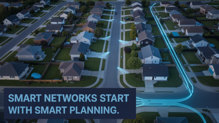
Improving Permitting Accuracy With Better Documentation
Permitting delays often occur because existing records do not reflect real-world conditions.
Drone flights generate detailed imagery and orthomosaics that clearly show poles, pedestals, manholes, and other infrastructure. When reviewers can see accurate asset locations and surrounding conditions, permit applications require fewer revisions and less back-and-forth.
This applies across broadband, utility, and construction projects. Better documentation shortens review cycles and reduces uncertainty.
Experience Is the Difference
Drones are not the differentiator.
Experience is.
Broadband projects demand precision, regulatory awareness, and reliable data collection. When those standards are already part of daily operations, the same drone workflows extend naturally to utilities, construction documentation, inspections, emergency response, and permitting support.
The technology is the tool. The value comes from knowing how and when to use it.
Frequently Asked Questions
How does CHR Solutions use drones for broadband projects?
CHR Solutions uses drones to collect imagery and sensor data that supports broadband engineering, permitting, and construction planning. Flights are conducted near active infrastructure and in regulated airspace to capture usable data the first time.
Why does drone experience matter?
Telecommunications environments involve live utilities, safety constraints, and airspace restrictions. Experience reduces missed assets, incomplete coverage, and repeat site visits that can delay projects.
How are broadband drone workflows applied to construction projects?
The same flights used to document broadband corridors are adapted to capture construction milestones, creating time-stamped aerial records that support accountability and dispute resolution.
How do drones support emergency response?
Drones provide live aerial visibility when responders cannot safely access a scene. Thermal imaging can also be used to track movement and guide response efforts in low-visibility or hazardous conditions.
How does drone data help with permitting?
High-resolution imagery and orthomosaics clearly show existing infrastructure, helping permitting authorities understand site conditions and reduce revisions.